
Baytown Neighbor Source Layers
Baytown neighbors are best researched as an immediate parcel question. The City map supplies geographic context, including city limits, ETJ, annexations, ZIPs, precincts, building footprints, and districts. Harris Central Appraisal District or ChambersCAD supplies the appraisal parcel track. The relevant county clerk holds the recorded deed and instrument track. A historic directory, local newspaper, or civic group can add a dated community lead. Each source should be labeled for what it actually shows. None supplies a verified roster of everyone who presently lives on a block.
| Source | What it shows about a block | Baytown access |
|---|---|---|
| City GIS and Specific Web Maps | Address routing, parcel selection, city or ETJ context, ZIP, precinct, districts, and city services. | Online address or County Parcel ID search. |
| HCAD or ChambersCAD | Appraisal parcel, owner and mailing fields, legal description, tax context, and map clues. | Use the county tied to the address. |
| County clerk index | Recorded deed parties, instruments, legal description, file number, and recording date. | Online index plus clerk counter or copy route. |
| Voter and precinct tools | Precinct or polling-place context and regulated voter data. | County-specific tools and state request process. |
| Civic and history sources | Association, activity, older neighborhood, or street-map context. | City pages, Sterling Municipal Library, and preservation contacts. |
Start by distinguishing a situs address, the physical parcel location, from an appraisal owner and a mailing address. The owner line may be a taxpayer record, and mail may go elsewhere. A historic directory is a dated household lead. Those distinctions prevent a Baytown neighbors search from turning a parcel map into an unsupported conclusion about an individual.
Baytown GIS Parcel Method
The Baytown Specific Web Maps page accepts an address and returns jurisdiction, zones, utility districts, sanitation, school districts, parks, and city-resource contacts. The Baytown GIS entry accepts an address or County Parcel ID. Select the parcel, turn on the parcel, road, and building layers that are available, and inspect polygons sharing a boundary. Record parcel or account identifiers instead of copying a name from a map. Then query each adjacent parcel in the appropriate county system.
The flow is: address or County Parcel ID to selected parcel, selected parcel to adjoining polygons, adjoining polygons to parcel or account IDs, then the right county CAD and clerk index. Baytown GIS does not have one universal resident field. It provides the spatial layer. CAD and the clerk provide separate appraisal and recorded-instrument layers. Confirm the county before opening either, because a single Baytown map view can cross the Harris and Chambers line.
The Baytown parcel and layer service is the map source for a Baytown neighbors parcel check.
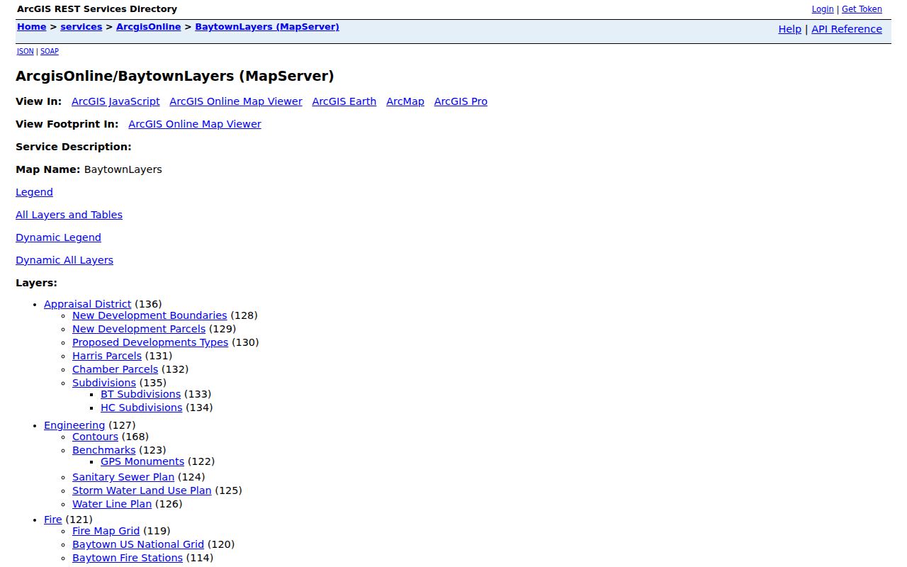
Keep the layer names and access date with a map result, because ZIP and voting-precinct layers can change.
Baytown Neighbor County Routes
For Harris-side parcels, HCAD published guidance supports account, owner-name, and address searches, although the live host returned a 403 response during text inspection. Treat the exact live fields and parcel-card output as a browser-verification gap. The Harris County Clerk real-property index supports file number, date, grantor, grantee, trustee, subdivision or description, instrument, volume, page, lot, block, and tract searching. Its online property images begin November 1, 1960. Earlier material and raised-seal certified copies require the office or older microfilm path.
For Chambers-side parcels, ChambersCAD visibly offers owner name, street, city, ZIP, property ID, Geo ID, legal, street-number, subdivision, tax-year, property-type, and sorting controls. The Chambers Official Public Records portal supports grantor, grantee, subdivision, document type or number, recorded dates, and index-only or index-and-full-text searching. Its current certification date does not establish the historic online cutoff. For older material, the Anahuac and West Annex deed rooms have public computers. Ask the clerk about the right book or counter route instead of assuming an online gap means no record exists.
Note: A CAD owner field and a recorded deed both concern property records, but neither independently proves current occupancy.
Baytown Neighbor Tool Boundaries
Official records and commercial neighbor-search categories serve different purposes. A county or city source identifies the custodian, field names, jurisdiction, and access limit. A commercial compilation may blend old addresses, phone associations, public-index fragments, and purchased data. That mix can create same-name joins or stale address links. When a result matters, use an official parcel, deed, court, voter, or qualified vital channel as the verification source. Do not turn a collection of clues into a personal dossier.
| Official source | Commercial neighbor category |
|---|---|
| Names the record custodian and shows the record’s date, field limits, and jurisdiction. | May combine sources with uneven dates, county coverage, and matching methods. |
| Separates map geography, appraisal data, and recorded instruments. | Can blur a past address, mailing line, or owner record into a current-person claim. |
| Offers a correction, copy, counter, or request route. | May offer an opt-out, but that does not remove the underlying government or historical record. |
For a full named-street record chain, the Baytown street directory follows the address, legal description, clerk index, and historical street tools more deeply than a block-level check.
Baytown Neighbor Voter Boundaries
Voter sources are civic tools, not a block roster. The Harris Voter Search and Sample Ballot requires an election date and accepts name, address, certificate number, or VUID. Harris precinct data also offers voter products by district or ZIP, but Election Code §18.009 restricts advertising or promotion using voter information. The Baytown ArcGIS production voting layer has a Harris or Chambers field and a four-digit precinct field, which is useful for routing an address.
Texas rules make name, date of birth, and VUID public voter-registration information while suppressing SSN, driver-license or personal-ID numbers and protected residential information. Ballot choice is not public. Harris has a voter address-confidentiality form, and the Texas Secretary of State has additional protections for eligible people. Check a polling place or precinct through the county tied to the address. Do not use proximity to an address as proof that a person is publicly listed, registered, or a current Baytown neighbor.
Baytown Neighbor Civic Contacts
Neighborhood organizations can explain a local area without supplying a membership list. The state HOA management-certificates search has county, city, and ZIP filters and recorded Baytown-area rows such as Lakewood Estates HOA, Pelly Place Community Association, Scotts Bend Community Association, Meadowlake Village HOA, Country Meadows HOA, and Riverside Estates Residential Community. The state cautions that the results are not guaranteed complete or reliable. A certificate is an association lead, not a list of Baytown neighbors.
Neighborhood Crime Watch
Baytown Police helps organize Crime Watch Areas, offers prevention training, and supports clean-up activity. Contact 281-422-5152 at 3200 N Main for civic program information.
Adopt-a-Spot Spotlights
City spotlights identify active areas and groups, including Allenbrook Neighborhood Association, Lakewood Estates, and Lakewood Neighbors. The recognition list is not a directory.
Pelly Improvement Program
The City program preserves neighborhood-revitalization geography and community participation material. Its program contact is 281-420-5398.
The Texas HOA certificate search is the source for the Baytown-area association filter.
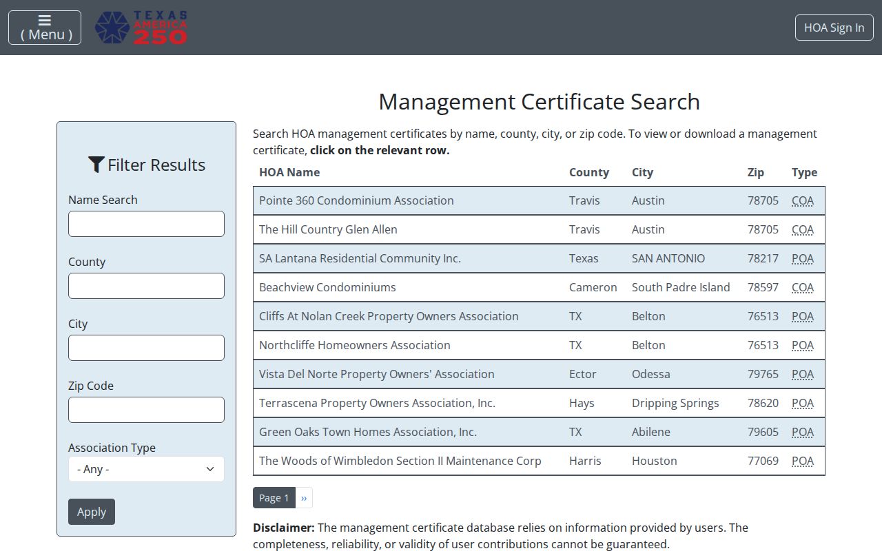
Use its county and ZIP fields to find an association certificate, then contact the listed organization through its own public channel.
Baytown Neighbors Community History
Some block questions are historical. Sterling Municipal Library has local files, street maps, newspapers, yearbooks, oral histories, and genealogy databases. Those materials can reveal an earlier neighborhood name, community activity, or street alignment when a modern association page does not. The Baytown Sun Index Only covers 1932 through 2017, and Sterling microfilm or the UNT full-text collection can supply issues not digitized. Baytown’s historic labels matter: older records may say Pelly, Goose Creek, Tri-Cities, East Baytown, Cedar Bayou, or Wooster rather than the modern city label.
Pelly and Goose Creek incorporated in 1919, Pelly was annexed in 1945, and the Baytown charter followed in 1948. This history explains why a former community name can unlock a map, newspaper, or directory search. It does not turn an older directory line into a current neighbor record. For historical support, Sterling’s local-history desk and the Baytown Historical Preservation Association are the handoff routes when a map or directory scan stops short.
Baytown Neighbor Safety Contacts
The Baytown Neighborhood Crime Watch page is a civic contact route, not a resident list. It describes Police support for Crime Watch areas, training, and clean-up efforts. Baytown Planning and Development, Neighborhood Protection, and Code Enforcement also use address-specific processes for maps, existing program records, or a documented complaint. If a municipal record is needed, use the City’s written Texas Public Information Act process for an existing record. Do not ask an office to build a new list of Baytown neighbors.
The Baytown Crime Watch page provides the source for a community-contact lead.
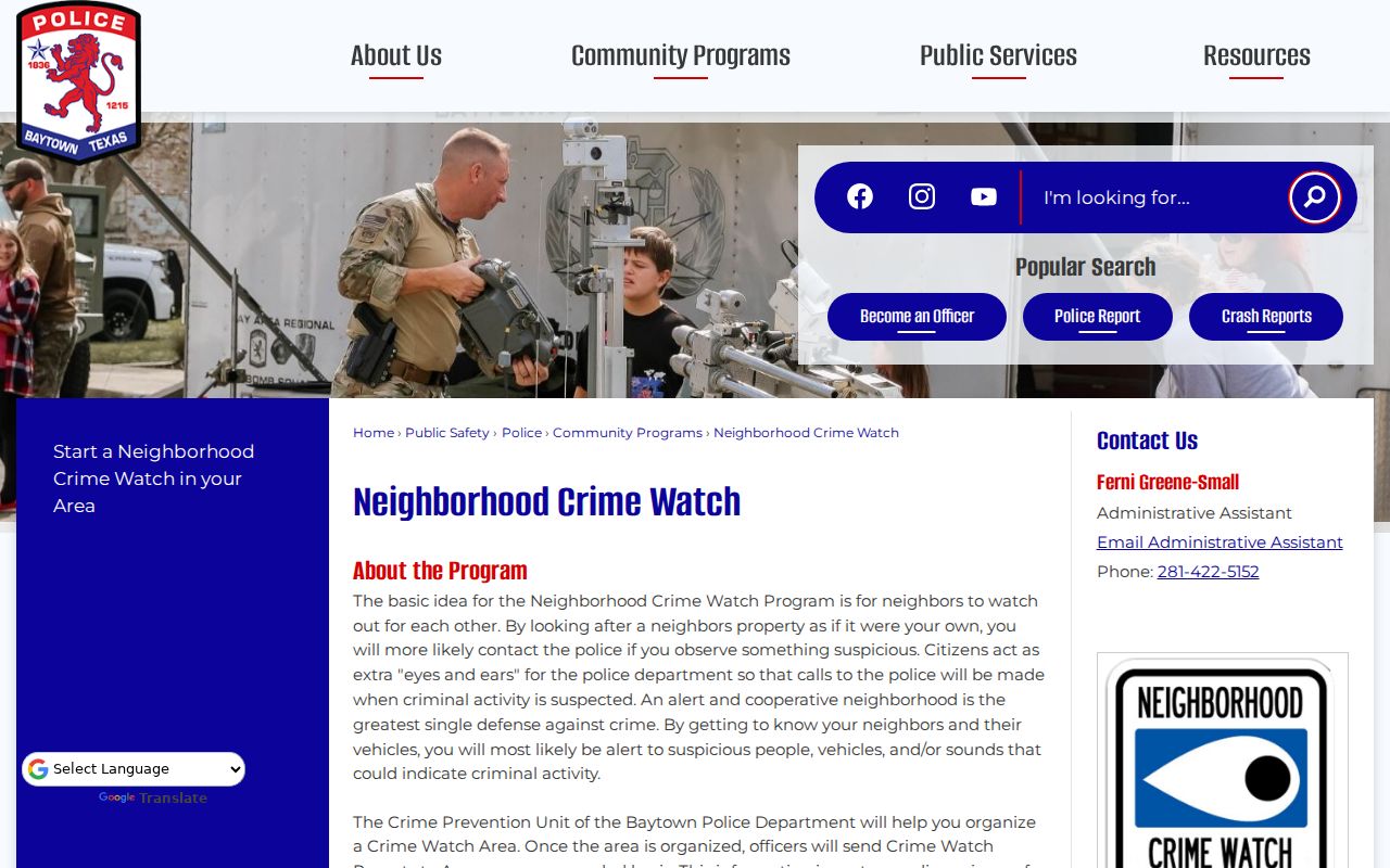
The program can help connect a block to civic resources without publishing household identities.
Note: Preserve the map date, record URL, and county choice, because a nearby parcel can route to a different jurisdiction.
Baytown Neighbor Privacy Limits
Baytown neighbor research has firm limits. Texas public-information rules commonly protect living-person birth dates, driver-license numbers, financial information, juvenile records, and protected official details. The Texas Address Confidentiality Program uses a substitute mailing address for eligible survivors, and its records are not public. Harris voter rules can suppress protected address details. HCAD can display “CURRENT OWNER” instead of a name. A private field, a blank result, or a concealed owner line can be the correct privacy outcome.
Lawful use. Use Baytown neighbors information for civic understanding, family history, neighborhood curiosity, record correction, or personal safety. Never use an address or record to stalk, harass, threaten, impersonate, or expose a protected person.
For an incorrect government record, contact the office that maintains it. Do not try to work around a suppressed field by using another address, map layer, or public index.