
Trace Previous Residents at a Baytown Address
Previous residents leave different kinds of evidence in different eras. Begin with the parcel and the county. Then select the source that matches the period in question. A deed connects recorded owners to a legal description; a street or householder directory can offer a dated household lead; a newspaper citation can lead to an obituary or local event. The past-resident trail gets stronger when each item agrees on the same address, legal description, date and historical community name.
| Source | Years it covers | Where held | What it shows |
|---|---|---|---|
| Harris recorded-property images | From November 1, 1960 online | Harris County Clerk portal and copy route | Recorded instruments, parties, dates and legal descriptions |
| Chambers official-records portal | Historical online start not located | Portal, Anahuac and West Annex computers | Index, OCR option and recorded-property leads |
| Tri-City Directory | 1929–30 | UNT Portal | Names, addresses and community businesses |
| Baytown directories | 1967; 1979–82 digitized runs | UNT and Sterling Municipal Library | Street, householder, alphabetical and telephone clues |
| Baytown Sun Index Only | 1932–2017 | Sterling and its local-history resources | Obituary and article citations, with microfilm follow-up |
| Federal census | 1790–1950 public schedules | National Archives and library databases | Household, age, birthplace and address detail when available |
For a recent transfer, use the county appraisal record and deed index first. For an older household, start with the closest directory or newspaper lead, then reconnect it to the parcel through a deed, map or legal description.
Begin a Baytown Parcel History
Baytown’s county split controls every property search. Use USPS and Baytown Specific Web Maps to establish the delivery and municipal context, then search HCAD or ChambersCAD for the applicable parcel. Save the account or property ID, situs address, legal description, subdivision and lot/block details. The legal description is the durable join between an old instrument and a modern parcel, whereas a street address may be abbreviated, renamed or aligned differently in historical material.
Keep the owner, mailing address and situs in separate columns in a notes sheet. The appraisal record is a tax record, not proof of title or occupancy. A recorded deed, map or release belongs in the county clerk chain; city GIS is the geography bridge between them.
Baytown Previous Residents in Harris Deeds
The Harris real-property search supports file number, film code, date range, grantor, grantee, trustee, subdivision or description, instrument type, volume, page, section, lot, block, unit, abstract, outlot, tract and reserve. Enter names last name first without punctuation. The online property-image start is November 1, 1960, while the current electronic index begins January 1961. That leaves the mid-century bridge as a counter or microfilm question rather than a reason to stop the search.
The Harris image below comes from the official real-property search.
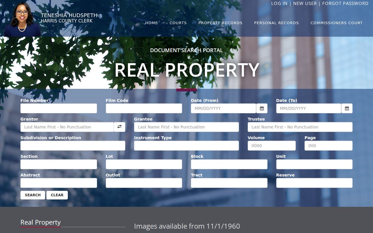
Record the instrument or file number, recorded date, grantor, grantee, legal description and image status before moving to the next transfer.
Walk Back a Baytown Deed Chain
A chain of title is the sequence of recorded transfers for the same land. Starting with the most recent owner record, use the latest deed’s grantee and legal description to find the earlier conveyance. The prior purchaser often appears as the current seller in the later deed. Search the legal description or subdivision when a street address does not retrieve the document, and compare every deed to the CAD parcel and GIS geometry.
- Confirm the county and retrieve the current CAD parcel, tax year and legal description.
- Find the most recent recorded deed in the proper county clerk index and copy its document or file number and recording date.
- Search the latest seller as a grantee, and use the same legal description to locate that earlier purchase.
- Repeat backward, also noting liens, releases, restrictions, maps and deed-of-trust instruments where relevant.
- When the online trail ends, use the clerk’s counter, microfilm or copy route, then check library files and directories for household context.
- Grantor and grantee
- The grantor transfers an interest. The grantee receives it in the recorded instrument.
- Chain of title
- The documented sequence of transfers for the parcel, read backward from a later deed.
- Legal description
- The lot, block, subdivision, abstract or similar land description. It is often stronger than an old street address.
- Criss-cross directory
- An address-arranged directory used to find a dated household line from a street and number.
Chambers County Previous Residents
A Chambers-side Baytown address needs its own clerk search. The Chambers Official Public Records portal permits Quick or Advanced Search by grantor, grantee, subdivision, document type or document number, with a Recorded Date range and either Index Only or Index & Full Text OCR. At inspection, the portal said it was certified through August 28, 2026, but the historical online start was not located.
For an older record or a question about a copy, public computers are available at the Anahuac clerk office and West Annex in Mont Belvieu. The County’s deed room has its own counter schedule, and the online portal warns that it is not the official repository and may show redactions. This is the documented fallback, not a gap to fill by guessing at a Harris record.
Baytown Before the 1948 Charter
Older searches often need more than the word Baytown. Pelly and Goose Creek incorporated in 1919, Pelly was annexed in 1945, and the Baytown charter arrived in 1948. Humble laid out streets, utilities and employee lots in 1923. Those events explain why a former address, household or parcel may appear under Pelly, Goose Creek, East Baytown or Tri-Cities instead of the current city name.
The 1929–30 Tri-City Directory includes Baytown, Cedar Bayou, Crosby, Goose Creek, Highlands, Pelly, Stewart Heights and Wooster. Treat that list as a set of historical search terms. It is a local records story, not evidence that all of those names describe the same present-day parcel.
Baytown Previous Residents in Directories
The 1967 directory has a street guide and householders’ directory that can move from an address to a printed name or telephone clue. It also has an alphabetical section for checking the same line. The 1979 and 1982 Johnson’s runs provide additional comparisons, and the 1929–30 volume reaches the Tri-City period. Search by address first, preserve initials and spelling as printed, then compare the line to a newspaper, yearbook, oral history or deed.
Pair each dated directory lead with the nearest available federal census schedule. Federal population schedules run through 1950 under the 72-year access rule, and can include names, ages, birthplaces, street addresses and household details. An enumeration district is the Census Bureau’s local counting area; it can help when a Baytown street is not indexed. The broader collection details remain on the Baytown city directory page.
Baytown Library Trail for Past Residents
Sterling Municipal Library Local History is the documented fallback for local files, 1940s–1950s street maps, newspaper citations, oral histories, yearbooks, photographs and neighborhood material. The Baytown Sun Index Only is an index citation route, not the article image itself; Sterling holds Baytown Sun microfilm. A library request can turn a citation or old neighborhood name into the next address or document clue.
The UNT Baytown History Collection also holds digitized books, directories and yearbooks. Its landing page is shown below from the official UNT collection source.
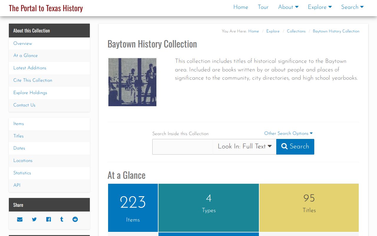
The collection is useful for dated community evidence, but a scan still needs a date, place-name and record-type check before it is paired with a parcel.
Baytown Map Gaps and Old Addresses
Sterling lists Digital Sanborn Maps and local street maps, but the research did not locate an official Baytown-specific Library of Congress map sheet or year. Do not assign a building date or map coverage from an unverified title. Instead, ask the library whether its licensed Digital Sanborn access includes the needed Baytown sheet, and record the year, coverage and scale before using it with a deed chain.
When an old address fails, test the historical community label, consult the street guide and maps, then return to the county clerk with the subdivision or legal description. This conservative route is especially important where a continuation street or a consolidated community name obscures the older wording.
Note: An unverified map reference is a research lead, not proof that a prior household occupied the modern parcel.
Baytown Previous Residents: Proof and Limits
Ownership and residence are not interchangeable. A CAD owner field can be a taxpayer record, a mailing address may be elsewhere, and a historic directory is a dated publication. HCAD can display “CURRENT OWNER” after an ownership-hiding request. Protected voter information and confidential personal data may be absent by law. Keep the result in proportion to the source: a directory is a lead, a deed image records an instrument, and an official certified copy has a different role.
For an obituary or family-history endpoint, use the Baytown Sun index and microfilm, then the appropriate county probate or qualified vital-record channel if a formal record is needed. The Texas Public Information Act can seek existing municipal material through a Baytown Open Records Request, but it does not require the City to create a previous-resident report or conduct legal research.
Lawful use. Use Baytown previous-resident research for family history, house history, estate questions, or personal curiosity, and never to track, harass, or harm a living person.